Central Europe SEEBASE
The Central Europe SEEBASE® study, funded by OMV, brings the benefits of a high resolution SEEBASE® model as previously commissioned by governments in Australia, New Zealand and the UK, as well as in nearly 200 proprietary studies, to onshore Europe for the first time.
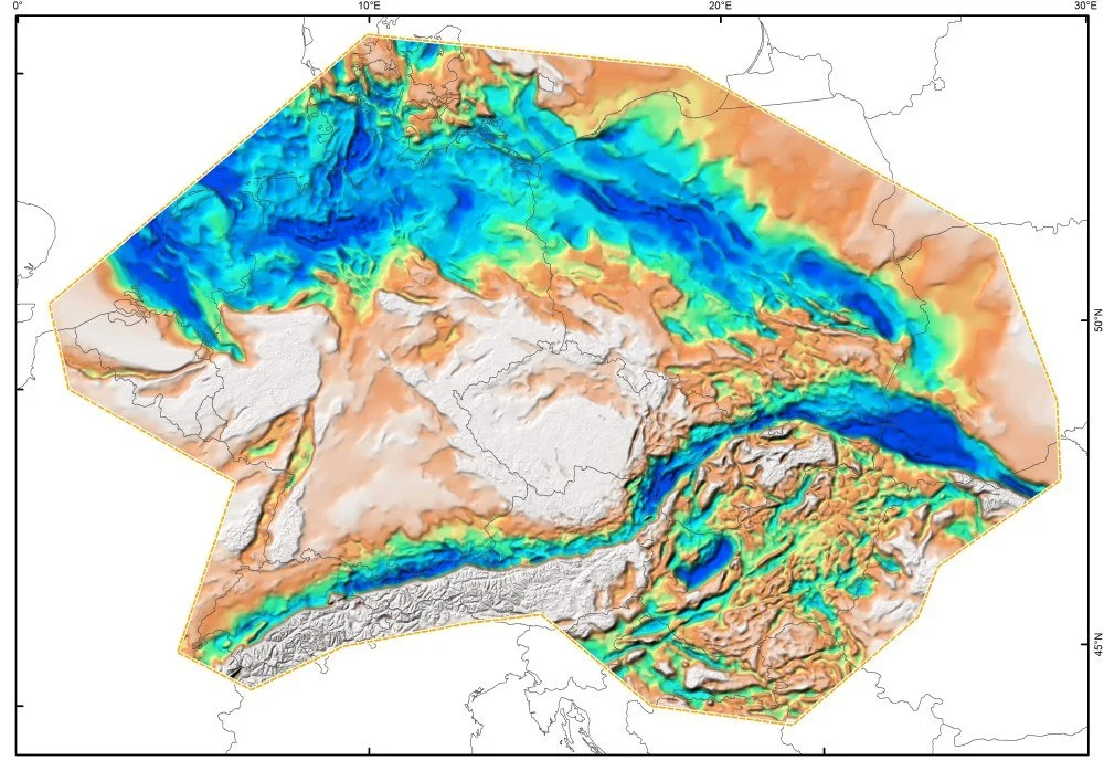
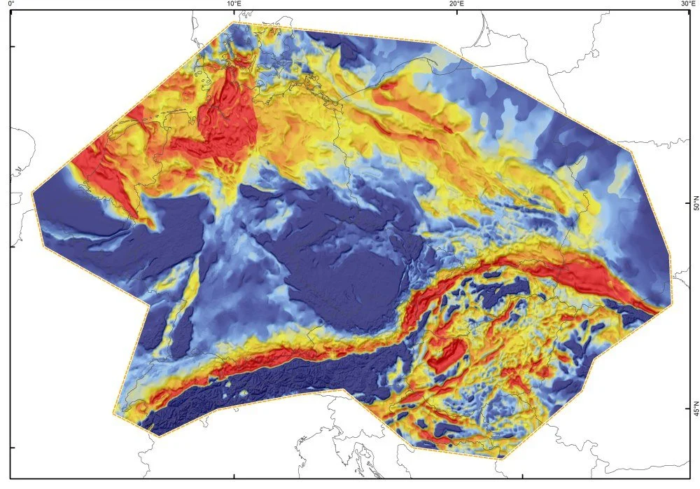
SEEBASE® is a geospatial model of basement and basin evolution developed through the iterative calibration, integration, and interpretation of a wide range of geological and geophysical datasets. By leveraging the SEEBASE® model, Geognostics has developed a geospatial and geological framework incorporating an upward series of key elements required in a full crustal regional geothermal model. The SEEBASE® Geothermal model differs from conventional ‘top-down’ heat flow studies, which often rely on downward-extrapolated subsurface measurements, to instead build a conductive heat flow model from the lithosphere-asthenosphere boundary to the surface, including key elements such as the contribution of upper crustal radiogenic heat production and transient heat flow.
The Central Europe SEEBASE® Geothermal model predicts basement heat input at the base of sedimentary systems and helps to explain geothermal anomalies from a basement perspective. The results provide foundation geological framework for understanding heat sources and geothermal systems, assessment of geothermal resource potential, and improved inputs and boundary conditions for subsequent basin and local-scale modelling.
The Central Europe SEEBASE® model can be improved, on a proprietary or open-file basis, through integration of additional data or focussed studies within specific countries or basins.
The study is delivered as an ArcGIS Pro project, with accompanying documentation, and is licensed under a creative commons (CC BY-SA) license.